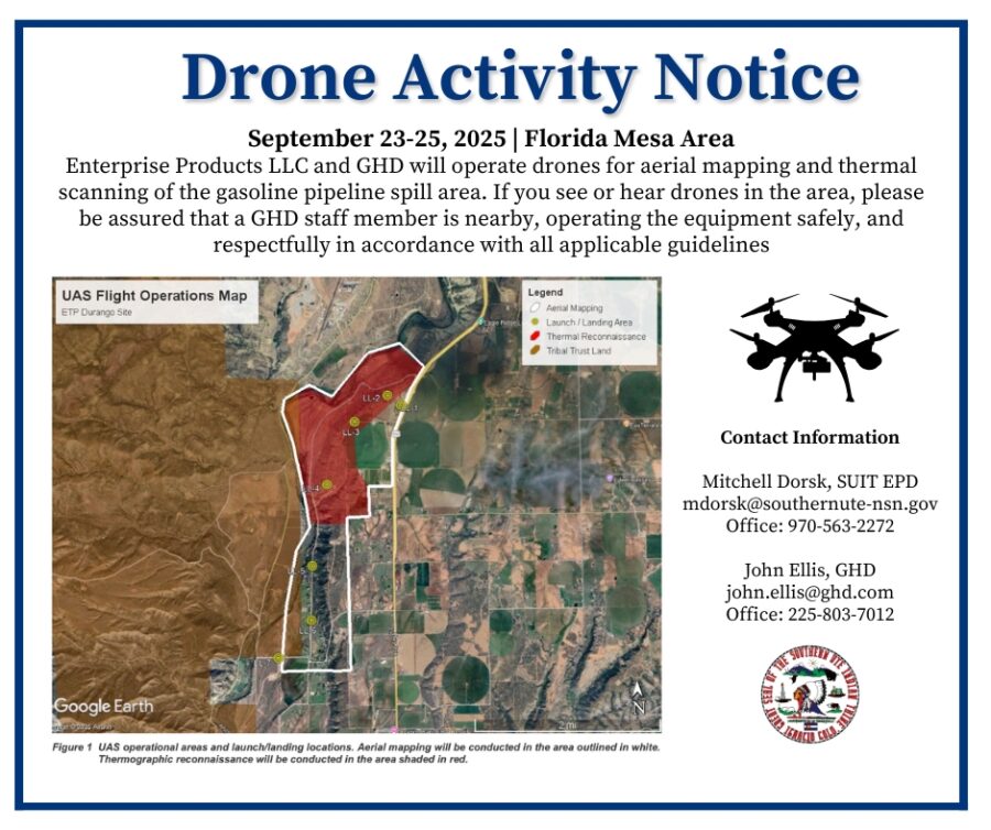
Enterprise and GHD are notifying the community of scheduled drone operations in the Florida Mesa area, specifically near Highway 550, County Road 219, and Rainbow Road from Tuesday, September 23rd through Thursday, September 25th.
These operations will support high-resolution aerial mapping of the broader gasoline pipeline spill area at approximately 400 feet above ground level during daylight hours. Additionally, thermal scanning will be conducted over a smaller, northern portion of the project area at approximately 200 feet above ground level during evening, nighttime, and early morning hours. Thermal scanning is scheduled outside of daylight hours to minimize interference from solar radiation, which can impact the accuracy of thermal sensors.
If you see or hear drones in the area, please be assured that a GHD staff member is nearby, operating the equipment safely, and respectfully in accordance with all applicable guidelines. We appreciate your understanding and cooperation!