
The Administration Division provides general administrative guidance and GIS support for all Departmental and Division programs.
Geographic Information Systems Program
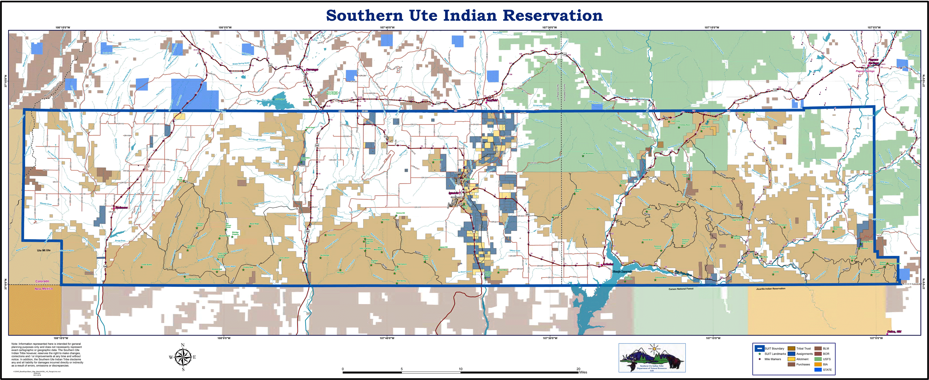
The Geographic Information System (GIS) Program of the Department of Natural Resources staff provides project-based spatial analysis, technical support, specialized maps, Web-Based Mapping Applications, and GIS/GPS training to DNR staff and other Permanent Fund Tribal Departments. They also provide a variety of maps to the Tribal Membership. The GIS program currently houses two staff members and works closely with the GIS Technician.
- GIS Manager
- GIS Analyst
- GIS Technician
The GIS staff works on a variety of projects on a day-by-day basis. In working with all of the DNR Divisions, as well as many of the other Southern Ute Departments (EP, SUPD, MIS, SUIMA) and Tribal Membership, the variety of projects can range from preparing data and hard copy maps for field work to providing an aerial image shot or a Tribal Member’s assignment for planning purposes, to creating a Division-specific web applications for quick access to GIS information.

GIS Manager
The GIS Manager administers the GIS program and supervises GIS staff. The GIS Manager acts as the Tribal liaison between county, state, private, and other Tribal GIS agencies, works closely with Emergency 911 services to develop and maintain accurate and consistent data for dispatching purposes, and works closely with SUSS to manage and maintain connectivity, security, and links to the enterprise RDMS (Relational Database Management System). The GIS Manager conducts trainings, does project planning and project work with other DNR divisions and departments, establishes instructions, guidelines, and protocols for GIS and GPS procedures, installs and maintains GIS and GPS software and updates, and develops and deploys GIS web applications. The GIS Manager provides polite and helpful assistance to Tribal Membership and attends meetings and trainings as required. Use the contact form (select GIS Manager) for information on acquiring hard copy maps or for assistance using the Interactive Web Mapping Application.
GIS Analyst
The GIS Analyst conducts spatial analysis and produces cartographic products (hard copy field and presentation maps) utilizing existing Spatial data sets or creating such from Auto Cad data, hard copy plats, recorded documents, historical summaries, or GIS data acquired from cooperating agencies and GPS field data. The GIS Analyst is responsible for creating, maintaining and administering quality control of geodatabases and datasets related to Tribal Land and Natural Resources (land assignments, transportation layers, utility corridors, ROW’s, archaeological sites) ensuring information is accurate and up to date. The GIS Analyst provides regular software training sessions to Permanent Fund GIS users. Use the contact form (select GIS Analyst) for information on acquiring hard copy maps or for assistance using the Interactive Web Mapping Application.
GIS Technician
The GIS Technician (GIS Tech.) administers the physical addresses for Tribal Membership and tribally owned buildings. Tribal addressing involves following the established Addressing Assignment Protocol, utilizing the latest version of ArcGIS software to update and maintain the spatial and attribute data in the “addressing” geodatabase, coordinating closely with SUPD and the Emergency 911 association, local utilities (LPEA, Century link, etc.) and surrounding municipalities (La Plata County, Archuleta County) to provide correct and current address information. The GIS Tech. is responsible for accurate and timely map production for presentation use or Tribal Membership, and for drafting posters, correspondence, reports, and other documents as required or requested. The GIS Tech. also maintains an address-based Tribal Census database. Use the contact form (select GIS Technician) for information on acquiring an address or address information on the Southern Ute Indian Reservation.