
Acting Tribal Planner
Colton Black
970-563-2275
Admin Support II/Project Coordinator
Roman Seibel
970-563-2283
Heavy Equipment Operator
Matthew Box
970-563-2271
Planning Project Coordinator
VACANT
Mission
Ensure that Tribal lands are preserved, occupied or developed in a manner which at all times considers and adheres to the best interests of the Southern Ute Indian Tribe.
Road Maintenance Request
Current Planning Documents
The following are Tribal Council approved documents that help guide transportation, land use designation and expansion, capital improvement projects, and more. All plans have gone through vetting processes that include Tribal Member and Tribal Leadership comment periods and often incorporate critical partners such as other Tribal Departments and Divisions, local towns and cities, counties, states, planning organizations, and even federal entities. The Department of Tribal Planning has digital copies of all the following;
2022 Long Range Transportation Plan (LRTP)
The Long Range Transportation Plan (LRTP) is a critical transportation planning document that the Tribe strives to update on a periodic basis. This plan functions to show a number of near- (1-2 years), mid- (3-6 years) and long- (7+ years) term projects that affect the Tribal membership and public at large. The Department of Tribal Planning uses this document not only to identify those projects by the categories mentioned above, but to also guide future development to address life safety issues, healthy transportation, and transit growth, and to keep our roads in compliance with federal standards. Through this document, the annual Control Schedule is created to show which projects will receive federal funding. The projects and overall planning document also help the Tribe to identify multiple partner agencies for projects, which have included the Colorado Department of Transportation, Colorado Parks and Wildlife, Town of Ignacio, and La Plata County, among others. Finally, we use the document to solicit additional grant funding where applicable.
2016 Tribal Transportation Safety Plan (TTSP)
In 2016, in conjunction with the Tribe’s LRTP update, the Planning Department was awarded an additional safety grant to produce its first ever iteration of the Tribal Transportation Safety Plan (TTSP). This document further elaborates on critical safety problems that affect the Southern Ute Indian Tribe and the greater Four Corners region. Through the creation process of the plan, the Tribe solicited responses from Tribal Members and key stakeholders about what the most important transportation safety issues were and how we might creatively solve them going forward. In addition to a litany of data to help drive projects based on the pursuit of safety, the document provides four areas of action that can be applied to a number of issues. As in the 2016 LRTP, a number of specific safety-oriented projects were identified during the plan iteration, many of which have been actively worked on since the plan was formally adopted in 2017.
2005 Comprehensive Master Land Use Plan (Update in progress)
The 2005 Comprehensive Master Land Use Plan (CMLUP) shows another dynamic side of the Department of Planning, as our focus is largely shifted from transportation issues and re-purposed to focus on land use designation and capital development within the Tribal Campus and areas in near proximity. The 2005 plan is still cited today in the development of projects and helped promote ideal and suitable locations for a number of large projects such as Growth Fund II, the Sky Ute Casino Resort, the Southern Ute Museum and Cultural Center and the Multi-Purpose Facility and Chapel. In many cases, rather than identifying sites specifically meant for one project, land was examined for fitting “designations” such as office, recreational, cultural, residential, and others. A plan update began in 2017 and more work is required before it can be submitted to succeed the current 2005 plan.
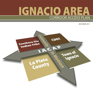 Ignacio Area Corridor Access Plan (IACAP)
The Ignacio Area Corridor Access Plan (IACAP) was formally adopted in 2011 after substantial work by the Tribe and its various stakeholders and additionally included CDOT, Town of Ignacio, and La Plata County as critical partners. The IACAP identified transportation and safety-related improvements along the State Highway 172 corridor, starting north of the Sky Ute Casino and continue south until the highway’s intersection with County Road 318. The document has been cited for a number of projects that have been completed or in progress since 2011, including a new signal and turning lane configuration in downtown Ignacio, the traffic signal near the Sky Ute Casino, the work along County Road 517, including a newly functional signal as of spring 2018, additional pedestrian crossings and sidewalks, and others. Like many planning documents, the original scope of the project intended to foster guidance for traffic development over the next 20 years, though many of the major projects have been completed in half that time.
* These plans do not include appendices due to the size constraints and limiting of some information for anyone who accesses the website; these appendices for every document are available from the Tribal Planning Department upon request.
Recently Completed or In Progress Projects
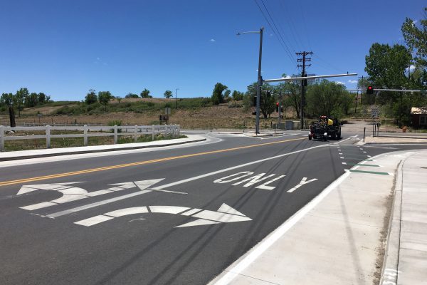
County Road 517 Road Reconstruction
First identified in the 2011 IACAP and further elaborated upon in the 2016 LRTP and TTSP, the CR 517 road reconstruction project is a multi-agency project designed to bring additional safety enhancements and traffic control to the route from State Highway 172 to Howe Drive. These items include a new traffic signal at the CR 517 / SH 172 intersection, the addition of a left-turn-only lane along the first leg of CR 517 until the Justice and Regulatory building, sidewalks on both sides within the same leg and a sidewalk on the West side for the duration of new construction, new retroreflective signs, additional pedestrian crosswalks, and bike lanes throughout the project. The Tribe worked in collaboration with CDOT and La Plata County to make the plan into a tangible project, one that is anticipated to solve many of the traffic and safety issues that had previously been cited along the route.
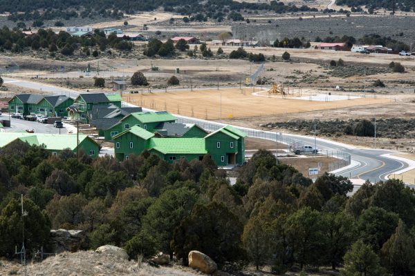
Cedar Point Housing Initiative (CPHI)
The Department of Planning has been a key member of the Tribe’s CPHI team as development has continued from a schematic design into the near full phase 1 buildout that is nearly complete as of spring 2018. Planning helped with a more refined master plan of the future of Cedar Point, which included the examination of a four-phase project, new routes and major updates to older ones, and future commercial possibilities, and helped with the creation of the extensive Master Civil Plan. Currently, the Planning Department plays a supporting role in assisting the core team with outreach to other agencies as needed and is working with the Department of Natural Resources – GIS to add new routes to the TTP road inventory network. Planning is also working with the Department of Construction & Project Management to address road issues on older routes within the subdivision and is hopeful to solicit additional federal funding to offer permanent fixes to common issues along the routes.
SU106 – End of Trail Road Reconstruction
Construction on SU106 – End of Trail was completed in fall of 2016 and had been previously identified on the annual Control Schedule, a document that is drafted based on eligible projects proposed in the LRTP. The route was in dire need of substantial work, and federal funding was solicited from the Federal Highways Administration (FHWA) through the Bureau of Indian Affairs to be able to complete the work. New construction included the addition of larger shoulders, new traffic signs, and, perhaps more notably, the addition of allocated parking spaces along the east and west sides of the route.
Other Short-Term Projects on Control Schedule
The following projects are also identified as short-term projects that the Department of Planning plays an integral role in, including coordination of Tribal staff for the project team, in addition to working with outside agencies to source additional funding or other forms of partnership:
- Cedar Point Road Rehabilitation
- United States 160 Wildlife Mitigation
- Southern Ute Indian Safety Guardrail
- Southern Ute 169 Road Reconstruction
Additional Functions of the Department of Tribal Planning
- The Director of Tribal Planning is a voting member on two major transportation commissions, including the Southwest Region Transportation Planning Region (SWTPR) and the Statewide Transportation Advisory Committee (STAC), both of which strive to address ongoing transportation regions across the state and in the southwest region.
- The Department of Planning routes requests comments (RFCs) for projects in La Plata County from appropriate Tribal Staff for input on how the project may impact the resources in their respective field. In addition, the department provides comments on proposed project notifications (PPN) that are provided by the Department of Natural Resources – Lands Division for projects within the exterior boundaries.
- Our department also works continuously with a number of other agencies mentioned above that include the Town of Ignacio, SUCAP, City of Durango, Town of Bayfield, Town of Pagosa, La Plata County, Archuleta County, Colorado Department of Transportation, Federal Highway Administration, Bureau of Indian Affairs – Southwest Region, and Bureau of Indian Affairs – Southern Ute Agency, among others.
For additional information on any of the projects or plans previously mentioned or to learn more about the functions of the Department of Tribal Planning, please contact us at (970) 563 – 2283.
Return to Departments